GIS 580 : SPATIAL BUSINESS INTELLIGENCE
EXERCISE # 4. PROJECT 4
Student : Sushmita Goswami Professor : Sergei Andronikov / Sara Hummell
Due Date : 05/29/2016
Submission Date : 05/28/2016
Student : Sushmita Goswami Professor : Sergei Andronikov / Sara Hummell
Due Date : 05/29/2016
Submission Date : 05/28/2016
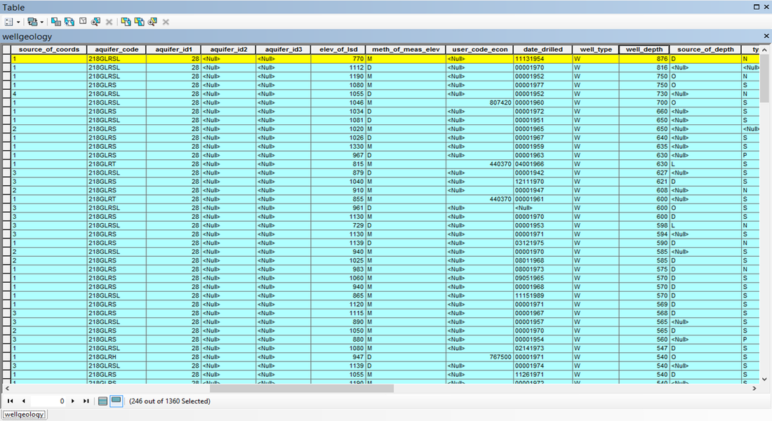
591 wells are situated on limestone.
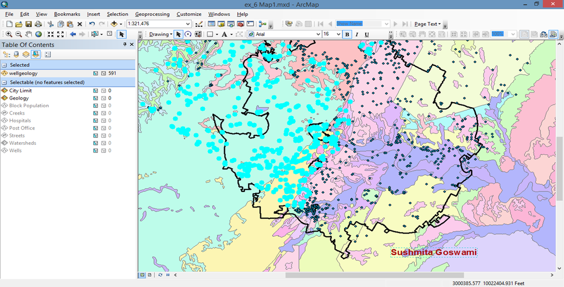
Minimum thickness of the Glen Rose Limestone near Austin is 876 unit (in feet).
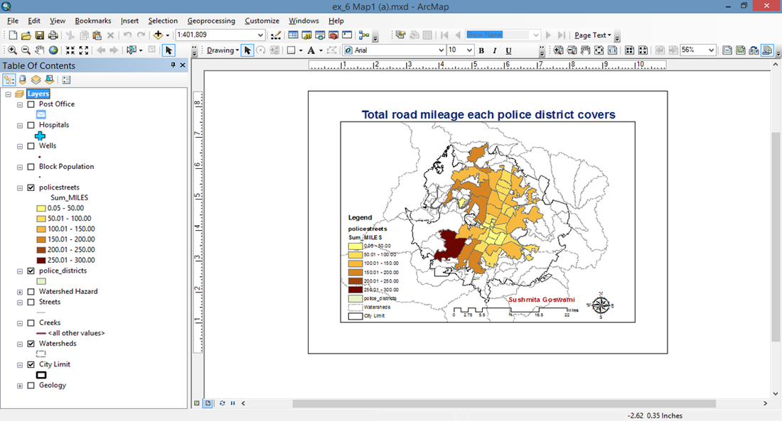
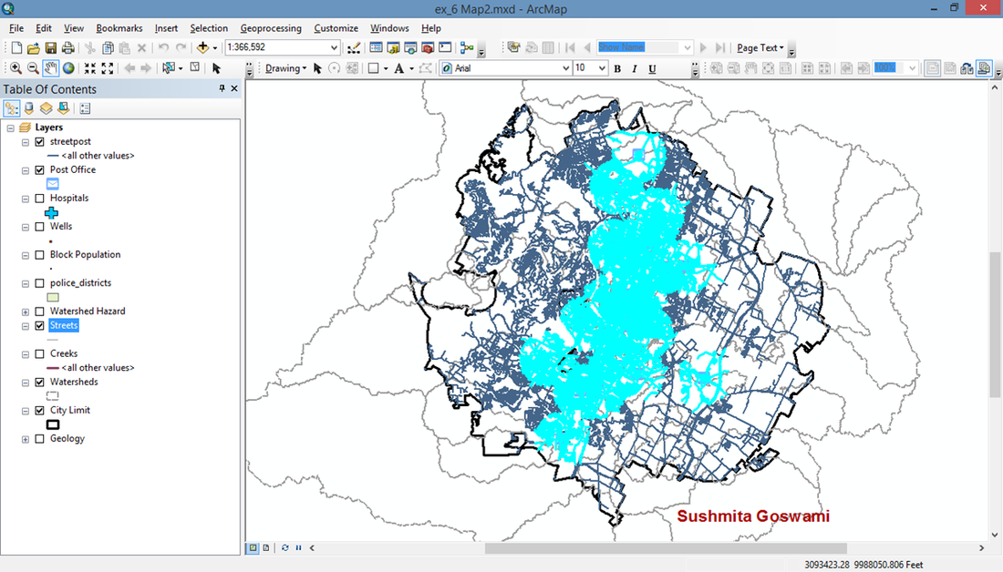
Map 1) Create a graduated color map of the policestreets layer based on the Sum_MILES field. For miles, it is best to classify the map using a defined interval of 50 miles.
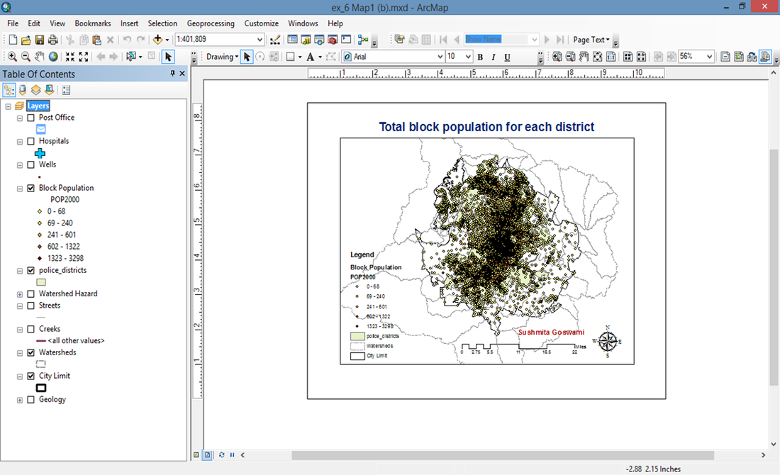
The next step might be to analyze the total block population of each district to see if they are balanced in that way instead.
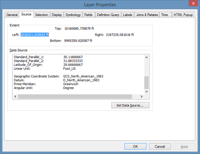
Geographic Coordinate System is GCS_North_American_1983. Units for the streetpost feature class are Angular unit - degree and Linear unit - Foot_US.
23 streets are more than two miles from a post office.
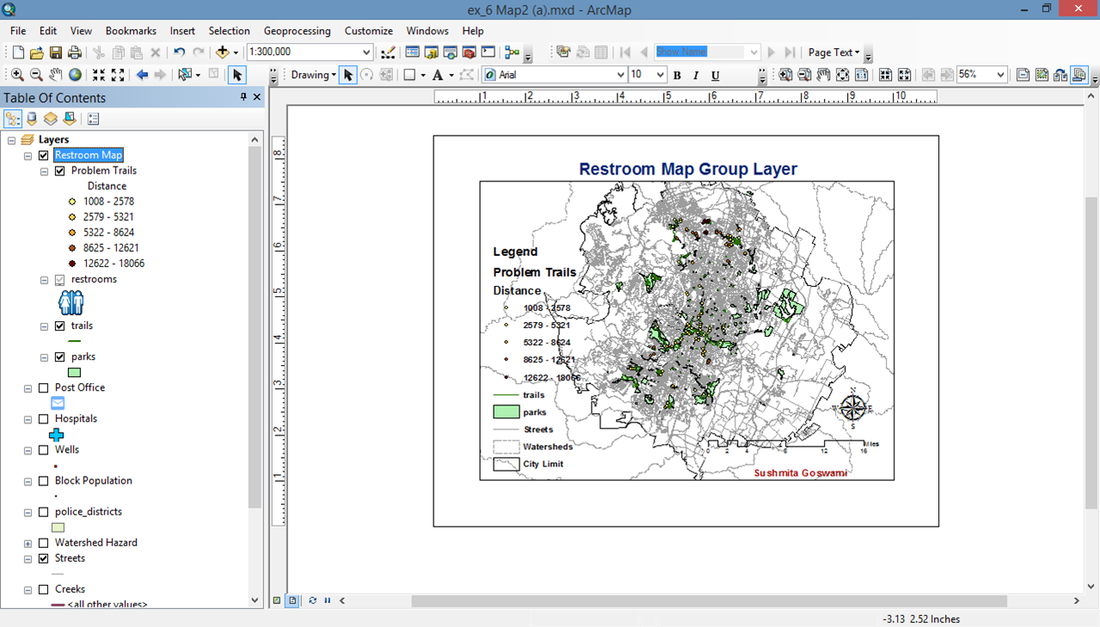
Map 2.) Restroom Group Layer Map
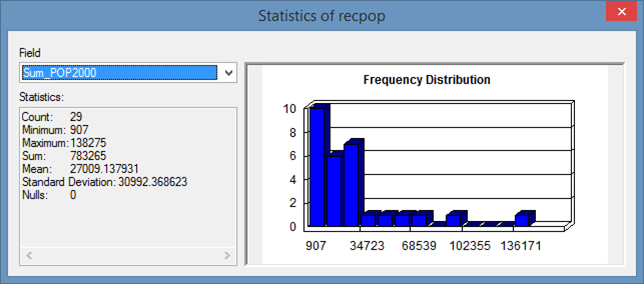
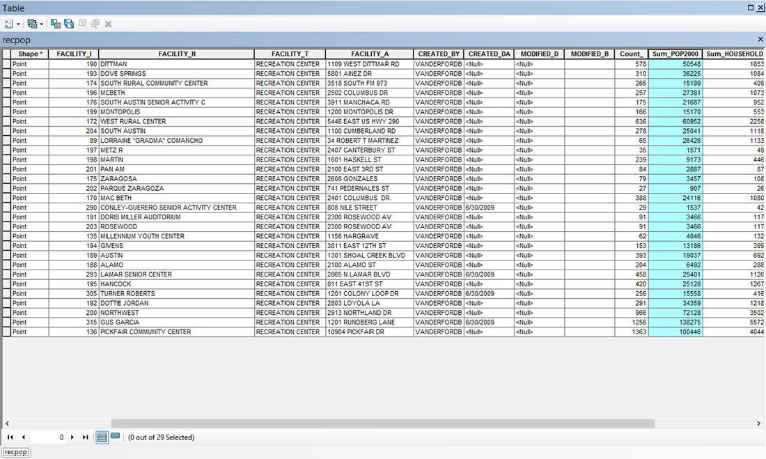
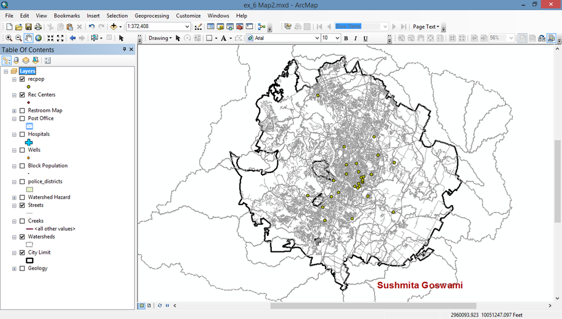
Numbers of people served by the recreation centers are Minimum - 907 people, Maximum - 138275 people and Average - 27009.14 people.
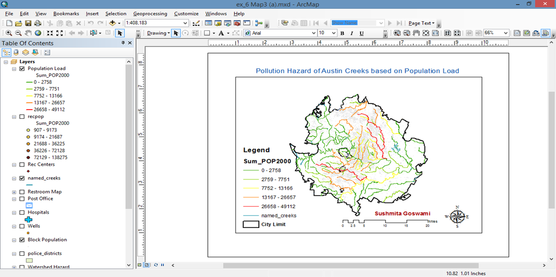
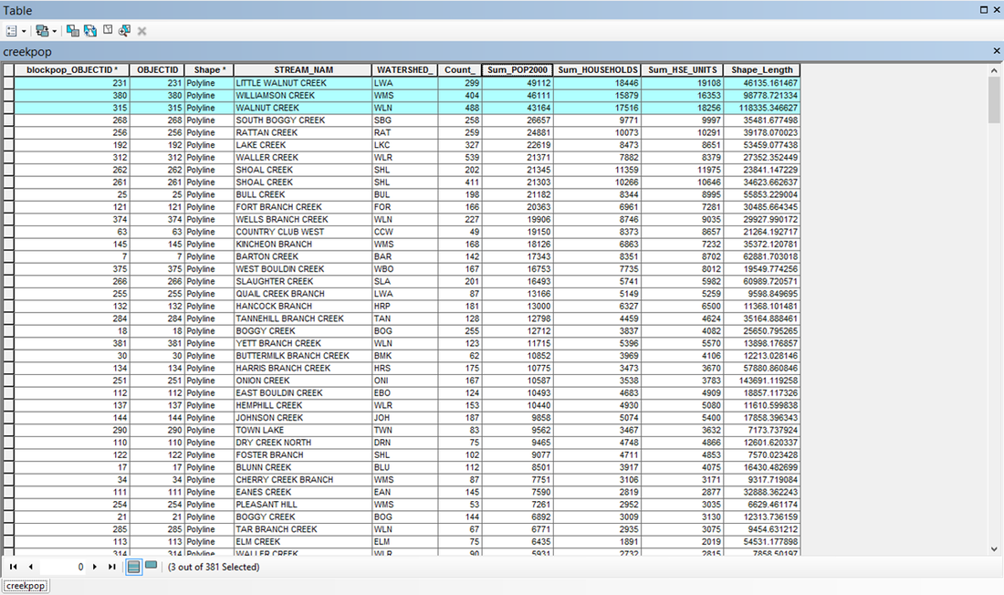
Three creeks having th highest risk based on total population are Little Walnut Creek, Williamson Creek and Walnut Creek.
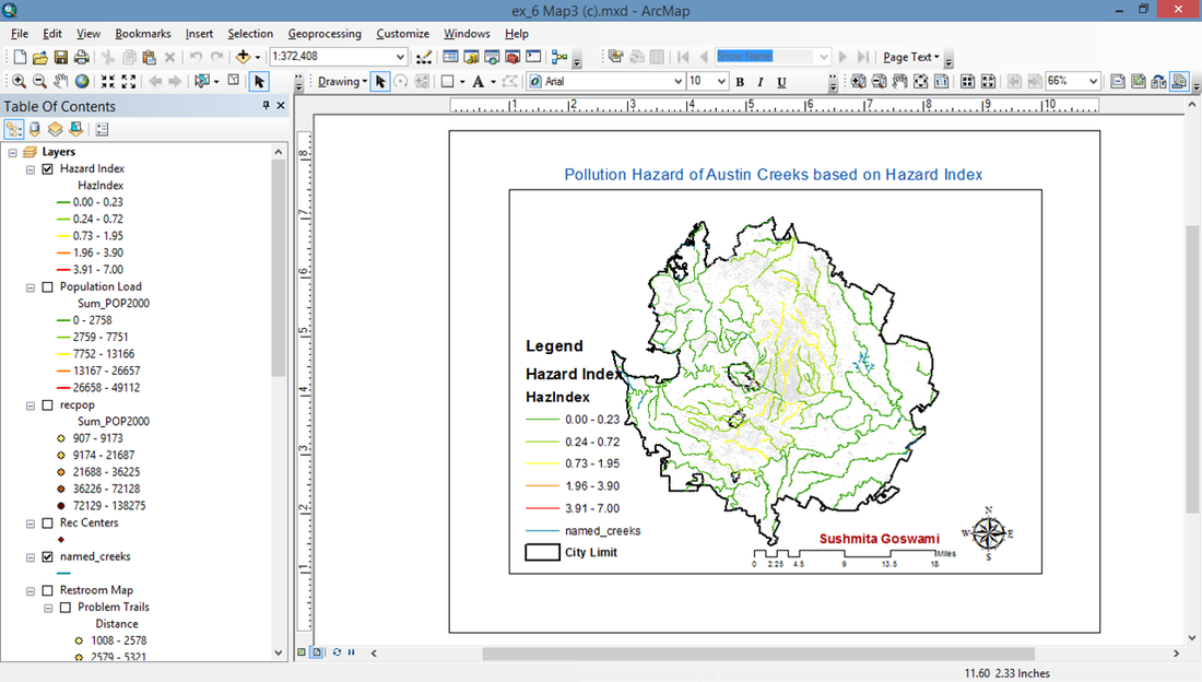
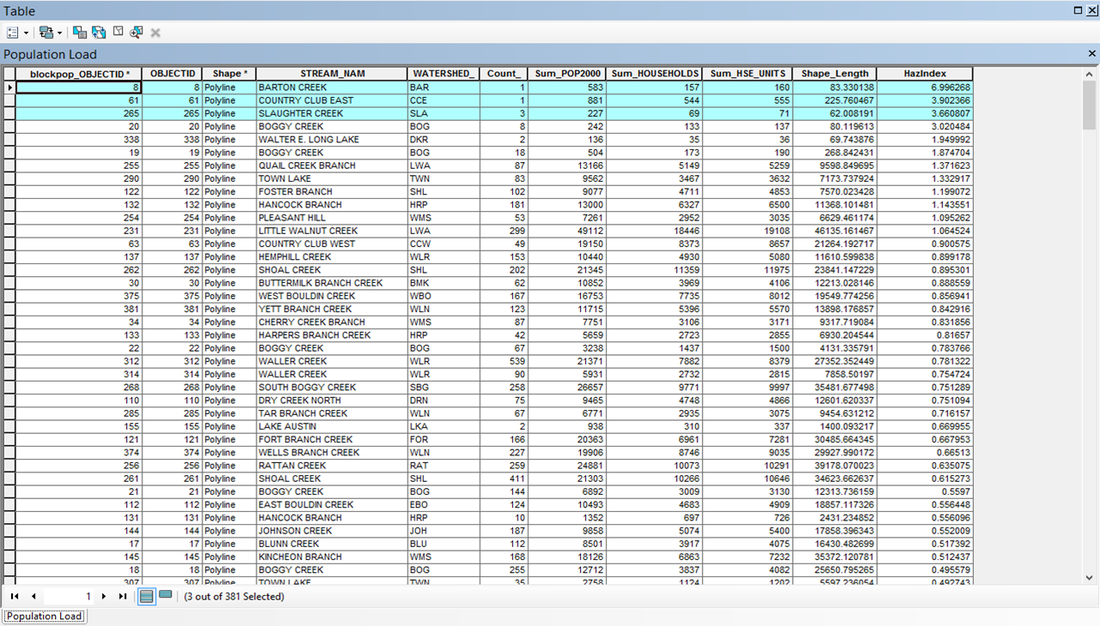
Three creeks having the highest risk based on the index are Barton Creek, Country Club East and Slaughter Creek.
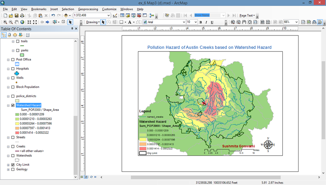
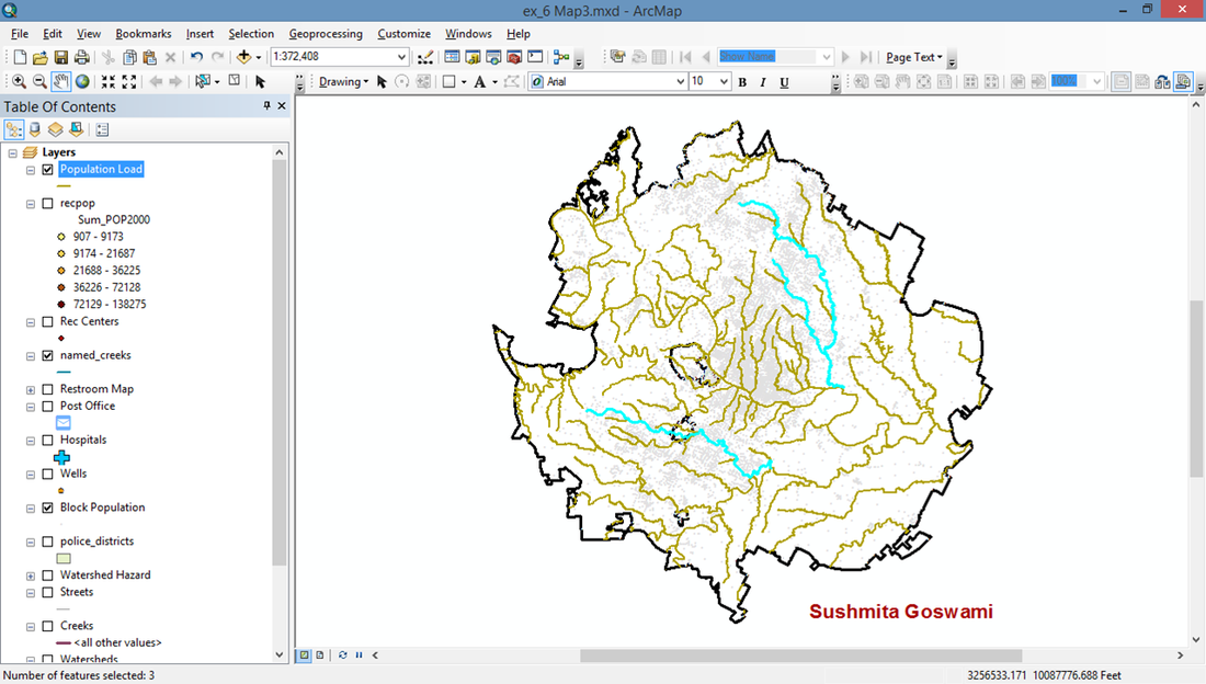
Map 3.) Approaches for evaluating pollution hazards